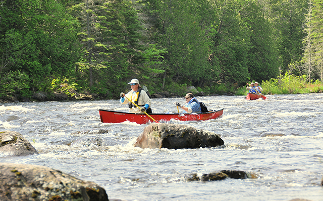
Chase Rapids is the highlight of many Allagash Wilderness Waterway canoe trips. This exciting stretch of class II whitewater is challenging for an experienced canoeist and will give a novice all they can handle, and then some. These rapids start directly below Churchill Dam and end nine miles downriver where the river enters Umsaskis Lake. The most difficult section of the rapids is the first mile and a half below Churchill Dam.
The first drop, right in front of the campsite, is standing waves that will get your adrenalin pumping. Below this will encounter rocks to navigate around, fast water to reckon with and shallow drops with no channel. About a mile downstream is a very large boulder in the middle of the river. This sets up canoeists for the section of river called “Devil’s Elbow,” the most difficult section of whitewater on the entire Allagash canoe trip. To successfully run Devil’s Elbow, you need to start this rapid on river right and gradually move towards the center of the river, as you descend this fast water over the next half mile, dodging rocks all the way.
The rapids finally take a break at Big Eddy, a nice deep pool where the current circles back upstream. This is a great place to take a break, empty the water out of your canoe, and take in the beauty of the Allagash.
When my wife and I were first dating, I took her and her sister down Chase Rapids. We took a break at Big Eddy. When it was time to go, I declared that we were through the worst of the rapids and the rest was easy. We didn’t secure our gear or fishing equipment. Well, right at the outlet of the Big Eddy pool, there is a big rock right in the channel. We hit that rock and upset the canoe in an instant. It makes for an interesting story now, but it wasn’t that much fun when it happened. I’m a lot wiser now than I was back in those days. I now realize that it only takes one small mental lapse and something bad can happen.
Waterway Rangers provide a portage service around the most difficult section of Chase Rapids and will transport canoeists and all their gear around the first four miles of the rapids for a small fee. Most people have their wanigan taken around the rapids and run this section with empty canoes.
The rest of the rapids are fairly mild, with small drops and rocks to navigate around all the way to Umsaskis Lake. The upper end of Umsaskis Lake provides some outstanding opportunities to view wildlife in their natural habitat. This marshy area is a prime moose feeding area. You will also find an abundance of other aquatic mammals and birds that thrive in a marshy environment, such as: otter, mink, muskrat, beaver, ducks, geese, and birds of prey. It is almost like a wildlife park, except it really is wild.
People often ask rangers to for advice on whether they should run the rapids or be shuttled around. My standard answer is that if you can read the river — see where to go — and make your canoe go there, you shouldn’t have much trouble. However, if you’re afraid to go, you should probably take the portage around the rapids.
Chase Rapids has a controlled flow from Churchill Dam. Waterway Rangers set the flow at or near 500 cubic feet per second every morning, an ideal flow for canoeing, and reduce that flow in the afternoon. The portage service around the rapids is available every day from 8:00 a.m. until noon.
Waterway Notes: Josh Plourde has been promoted to Allagash Park Ranger, and is now stationed at Allagash Lake. Landvest will be replacing the bridge on the American Realty Road at the Umsaskis Thoroughfare during August and September. Traffic will not be allowed over the bridge during that time, visitors wishing to access the waterway at Umsaskis should seek alternative routes.
Matthew LaRoche is superintendent of the Allagash Wilderness Waterway. For general waterway information, visit www.maine.gov/allagash, call 207-941-4014; or write to the Department of Agriculture Conservation and Forestry’s Bureau of Parks and Lands, 106 Hogan Road, Bangor, ME 04401.


