CARIBOU, Maine — Runoff from rain and melting snow continued to push waterways in Aroostook County closer to or beyond flood stage, according to the National Weather Service in Caribou.
The Fish River at Wallagrass was at 11.9 feet just before noon on Tuesday, nearly a foot above its 11 foot flood level, and already had forced the evacuation of some homes and the closing of Soldier Pond Road.
The St. John River at Fort Kent was right at its flood stage of 22.5 feet just before noon and causing minor flooding in low lying areas, according to the NWS. The forecast called for it to remain near flood stage through the day.

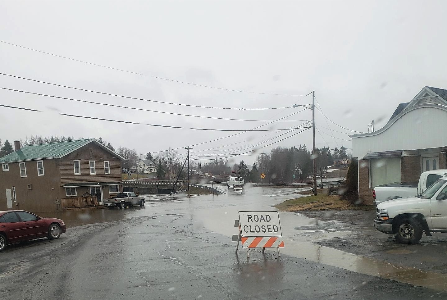
Families are evacuating their homes in Soldier Pond as flood waters from the Fish River continue to rise Tuesday. (Courtesy of Tracie Ouellette Desjardins)
The Aroostook River at Masardis remained at “action stage,” which is two feet below flood stage while further south, the Mattawamkeag River was at 15.41 feet, which is moderate flood stage, Chris Norcross, meteorologist at the National Weather Service in Caribou, said Tuesday morning. The Mattawamkeag flooded over Bridge Road in Haynesville.
The Maine Department of Transportation blocked access to Soldier Pond Road and Bouchard Street in Wallagrass on Monday when the Fish River crested flood stage there. As of Tuesday morning, all residents of Bouchard Street had evacuated their homes, according to Wallagrass Town Manager Lana Voisine.
She said the situation had gotten worse in the Soldier Pond area since Monday.
“The water is completely over the road now and is a lot more fast flowing,” she said. “I just got off the phone with Aroostook Emergency Management and they said it should go up a couple inches.”
Voisine said that some residents were considering evacuating from a home on Church Street.
Wallagrass resident Tracie Desjardins, whose home has not been directly impacted by the flood, said the river rose rapidly after Monday’s heavy rain.
“In the morning, people were able to pass (over the Fish River bridge in Soldier Pond), but soon, in the early afternoon, it was barricaded with a road closed sign,” she said.
“This happens just about every year, some years worse than others,” Desjardins said.
In Fort Kent, the Fish River continued to rise Tuesday morning but had not reached Main Street, parts of which had to be evacuated in 2008.
Ten years ago, 3 inches of rain and fast melting snow from a record snowfall that winter caused the St. John River to rise 8.1 feet in less than 24 hours and surge to 29.9 feet by evening on April 30. The Fish River crested at 14.6 feet that year.
The two raging rivers displaced hundreds of residents and caused millions of dollars of damage to buildings and infrastructure in 2008.
Most of the snowpack already has melted this year, and officials are not anticipating the rivers to rise anywhere near the 2008 levels.
The Fish River was causing minor flooding Tuesday in low lying areas behind the B and M apartments and Acadia Federal Credit Union on the south side of Main Street in Fort Kent. Where the Fish River approaches the St. John River, waters flooded the picnic area next to the Blockhouse. The St. John also continued to overflow into Riverside Park down river a short ways in Fort Kent.
Norcross of the Caribou weather office said Tuesday morning that there is still ice on some of the Fish River chain of lakes and that rain and snow melt would likely cause lake levels to continue rising over the next several days.

A swelling Fish River flows just under the Fish River Bridge in Fort Kent as vehicles drive across at about noon Saturday. (Andrew Birden)
Roads near lakes may be impacted by the rising water levels. Some minor flooding was occurring Tuesday around Long and Portage lakes.
Norcross said the forecast called for a chance of rain into Thursday and possibly rain on Friday.
Darren Woods, director of the Aroostook County Emergency Management Agency, said Tuesday that he has been getting up to five updates a day from the NWS in Caribou. He also has been watching the bridges, lakes and rivers throughout the region and is concerned about the rain in the forecast.
“Things have gotten slightly worse on Long Lake and Soldier Pond,” said Woods. “That could change, depending on the weather. In the coming days, I expect things to first get a bit better and then a bit worse. The next two days could be up and down because of expected rain and depending on how much we get. The prediction is different. We don’t know how much is going to fall.”
He said that he is watching the Fish River the closest.
“The Saint John River should be OK,” he said. “But we are expecting rain periodically over the next day and a half, and that will impact how much these rivers rise.”
Woods reflected on whether the area could flood, like parts of the St. John Valley experienced in 2008. He said that again depends on the rain.
“I have been talking to people who say that the lakes have risen to levels that they have seen back in 2008,” he said. “There are no gauges for lakes, but they have told me that the lake levels are up to a certain tree. I tend to believe people who have lived up there a long time.”
Writer Jen Lynds of the Bangor Daily News contributed to this report.
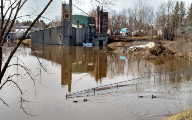
- An overflowing Presque Isle stream covers the grounds of the Trombley Redi Mix plant on Dragon Drive on Friday morning, April 27, as four ducks investigate the larger water mass. (Staff Photo/Paula Brewer)
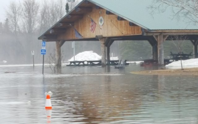
- The Lions Club Pavilion in Riverside Park in Fort Kent is surrounded by water late Saturday morning. Andrew Birden|Fiddlehead Focus
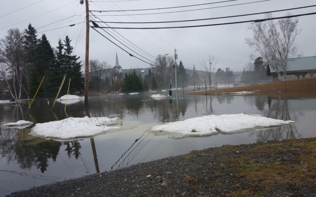
- Waters of the St. John River overflow into Riverside Park in Fort Kent late Saturday morning. The spire of St. Louis Catholic Church is seen rising in the background. Andrew Birden|Fiddlehead Focus
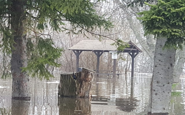
- Waters of the St. John River overflow into Riverside Park in Fort Kent late Saturday morning. (Andrew Birden | SJVT/FhF)
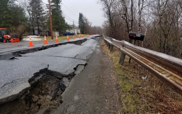
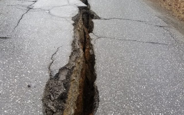
- Caribou Police have indefinitely closed a portion of the River Road due to runoff and ground saturation that has severely damaged the road. According to Chief Michael Gahagan, a big crack in the road has grown since this photo was taken and city officials may need to relocate the individuals living in the affected area if the situation grows to the point in which it threatens their safety. (Courtesy of Caribou Police Department)
- Caribou Police have indefinitely closed a portion of the River Road due to runoff and ground saturation that has led to a growing crack in the roadway. According to Chief Michael Gahagan, the rift has grown since this photo was taken this weekend and city officials may need to relocate individuals living in the affected area if the situation grows to the point in which it threatens their safety. (Courtesy of Caribou Police Department)

