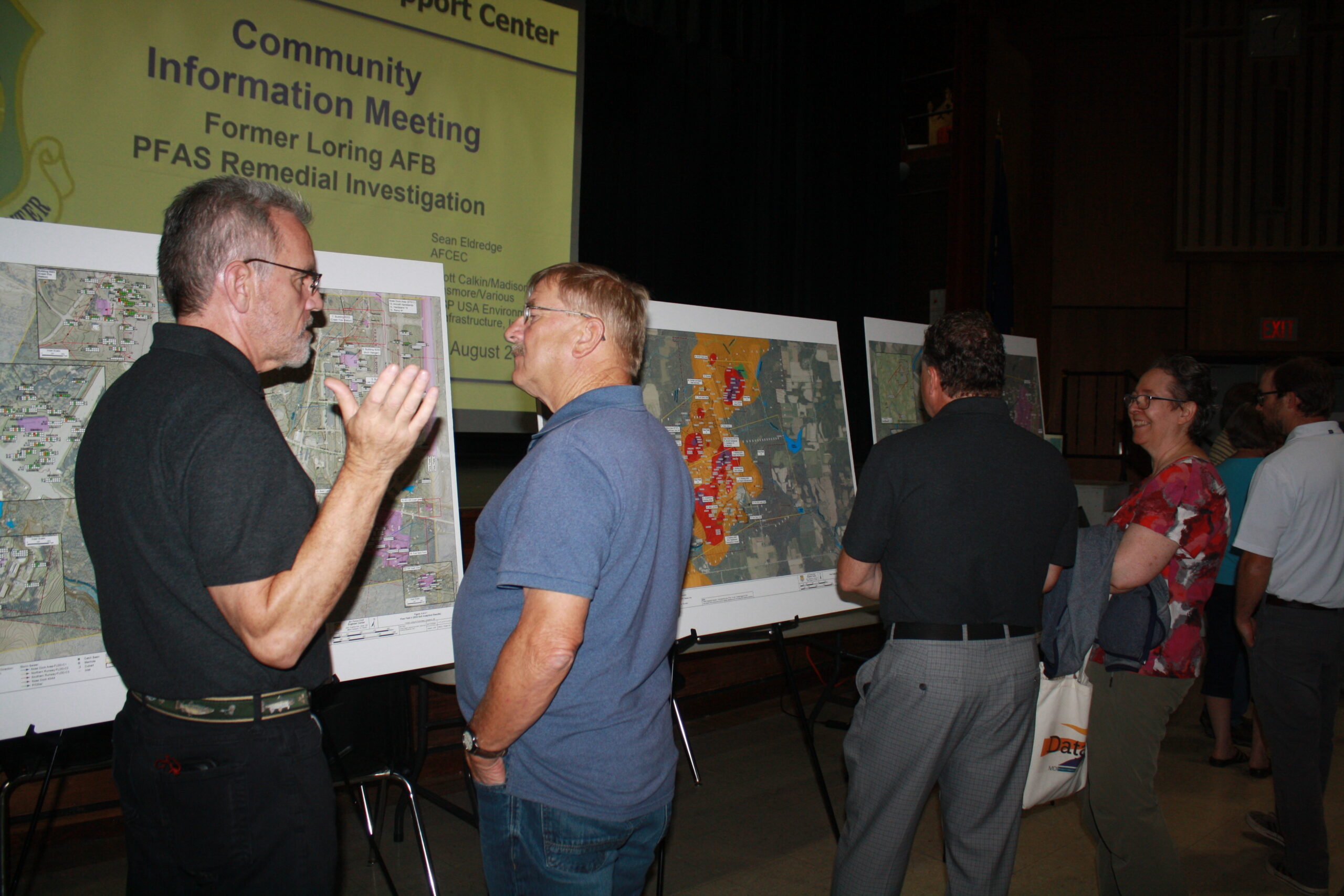
LIMESTONE, Maine – Testing for PFAS contamination at the former Loring Air Force Base has revealed evidence that “forever chemicals” are likely spreading into nearby lakes and streams near the base’s former airport.
Unsafe levels of one of the chemicals has been found in groundwater that eventually makes its way into waterways, according to research conducted by a company working for the U.S. Air Force.
In 2013, the Air Force contracted with environmental consultant company Wood Environment and Infrastructure, now known as WSP, to launch studies of PFAS within Aqueous Film Forming Foams, or AFFF, which responders used to put out fires and conduct training in buildings and on property near Loring’s runway.
Further investigation starting in 2022 found that AFFF existed in 21 sites of groundwater, surface water, soil, sediment, stormwater and fish tissue near the base. They have collected over 3,000 samples so far and testing is ongoing.
WSP researchers presented their latest findings to around 20 members of the public Thursday at Limestone Community School, their second meeting since introducing their study to residents two years ago.
The findings include levels of 40 PFAS varieties have been detected but are not above federal safety standards and PFAS has been spreading to area waterways since the base’s closure in 1994.
Testing on 39 private wells in Limestone, Caswell and Caribou since 2022 showed the presence of a PFAS known as perfluorooctane sulfonate, or PFOS, and perfluorooctanoic acid, or PFOA. The levels were not above the federal Environmental Protection Agency’s standard of 4 parts per trillion, according to WSP.
“We focus a lot on PFOS because it’s one of the more prevalent and toxic PFAS,” said Amy Quintin, WSP risk assessor.
When analyzing samples for PFOS in bedrock groundwater, researchers honed in on four “flow fields” around and near the airport that indicate chemical spread from bedrock groundwater into nearby streams and lakes where people have fished for brook trout and smallmouth bass.
In “Flow Field 1” on the northeast side of the study region, near Loring’s former fire training area, researchers found PFOS at unsafe levels of up to 11,000 parts per trillion. The remaining three flow fields, going from southwest and east to northwest, vary in their levels, from less than 40 to over 4,000 parts per trillion.
Because of the direction the PFOS seems to be moving in, there is reason to believe that the chemical has spread through streams and into waterways like East Loring Lake, Chapman Pit, Greenlaw Brook, Durepo Pond and Limestone Stream.
Maine’s Division of Environmental and Community Health has already issued warnings about Limestone Stream and Durepo Pond, advising people not to eat more than four meals per year of brook trout and no smallmouth bass because of the PFAS spread.
Randy Martin, executive director of the Central Aroostook Soil & Water Conservation District, asked if there is enough information on PFAS spread to assist area farmers, who use area waterways to irrigate their fields.
The District recently started a grant-funded study of central Aroostook waterways and farm crops to determine potential PFAS spread and what steps, if any, farmers might need to take, Martin said.
“We’re very concerned about agricultural land because using water for irrigating crops is a big thing,” Martin said. “No [farmers] have been taking irrigation out of Greenlaw Brook.”
Further studies of fish tissue and plant species are needed before WSP can know the extent of the PFAS spread and levels within private wells and public waterways, said Hank Andolsek, WSP project hydrogeologist.
Generally, when firefighters sprayed AFFF, the chemical appears to have moved from surface water to soils, then groundwater and into streams, further seeping into sediments below the surface, Andolsek noted.
“The highest concentrations [of PFAS] are in unsaturated soils [above water levels]. Once they get into the ground and start moving, you’re looking at migration potential,” Andolsek said. “We’ll use a computer to simulate the movement of groundwater and start teasing out potential remedies.”
WSP will continue sample collection in wells, fish tissue, plants, groundwater and soils throughout the fall and expect to begin writing their final report in 2025. That report will likely wrap up in fall 2026, said Madison Dinsmore, deputy project manager.
It will not be until the final report that WSP can fully know the potential health risks to humans, fish and other species, and propose clean-up plans, Quintin said.


